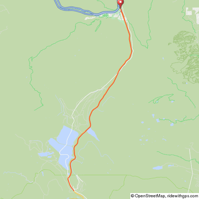
Fremont Pass (w/an option to continue to Leadville)
Fremont Pass has a broad summit and is the site of the Climax molybdenum mine and is the Tour de Tailing Ponds. The mine was closed for a number of years before being reopened several years ago.
The summit is 11 miles from Copper Mountain making for a 22-mile round trip with ~2,000' of climb from the Conoco station at Copper. This pass is often ridden in conjunction with a ride to Copper Mountain from Breck, Frisco, Dillon, etc. and/or on to Leadville. It is a 54-mile round trip with 3,500' of climb from Breckenridge or a 36-mile ride with 2,700' of climb from Frisco. Leadville is about 12 miles further on from the summit, adding 24 miles and 1,600' of climb on the return for a Copper/Leadville round trip. See the first portion of the Copper Triangle ride for a one way elevation profile from Copper to Leadville.
If you are riding up from Breck, Frisco, Dillon, etc., continue straight on the path as you approach the Copper area – do not make any of the right-hand turns that would lead you into the Copper resort. If you start at the Conoco station near Highway 91, make your way to this main path behind the Conoco station. Continue south on the path, paralleling Highway 91, until the path eventually ends and you merge onto Highway 91. Be aware that once you merge with Highway 91 there may be significant traffic heading to Freemont Pass. There is a fairly wide shoulder but you should still be careful – it’s best to pick a day with less traffic, avoiding weekends and holidays when possible.
Copper Mtn/Fremont Pass Out & Back
Click map for an interactive version and
downloadable GPS files.
The new bike path from Copper and Highway 91 both head south toward Fremont pass and are surprisingly straight for a pass with only a few turns near the summit. Note that there are a couple false summits before you reach the true summit at the mine. If your objective is Freemont Pass, turn around here and return to your start point. Enjoy the wonderful views as you descend back to Copper. Grades are 2.5% for 5.4 miles, 4.5% for 1.7 miles and 7% for 1.1 miles. The map of this ride assumes that Freemont Pass is your end point.
If you decide to ride on to Leadville, continue down the south side of the pass, taking you 12 miles through a valley to the city of Leadville.
Elevation Profile

22 miles, 1,800' of climb

